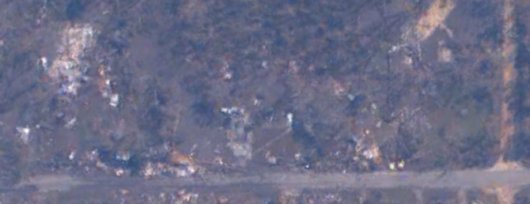
Yesterday I posted a Google Earth file marking all the churches in our Gulf Coast Baptist Association. The screen shot showed the pre-storm satellite imagery of our church currently displayed in Google Earth by default. The National Oceanic & Atmospheric Administration (NOAA) snapped satellite images a few days after the storm. You can dynamically overlay these images, within Google Earth, by downloading the katrina-overlays-netlink.kml file. Navigate to the gulf coast and click on one of the blue, red, or yellow dots to pull up the ability to view the overlays for that location. Choose the 4kX4k version for the sharpest detail.


7 Comments
Nearly two years later, this image still saddens my heart.
Praise the Lord for you, Pastor Don, as you continue to heed The Call, bringing Hope, Re-building and God’s Love into the area. HE is surely well pleased!!!
Don, that is chilling. Looking at it pre-Katrina made me sad, as I could imagine where everything is now. And I remember my conversation with Chip and the look on his face when he talked about how much he loved his home.
The men from our group are already asking when we can go back to Mississippi. My daughter, who will be in college is asking too. All of them said they’d prefer a winter trip this time.
Beth,
That sounds great. Come on back. Our fall/winter schedule looks pretty wide open now. We really depend on folks making return trips. It starts to cool down here in about October.
i’ve actually seen both of these images on google earth 4 weeks ago while doing research for my video i’m doin. It really puts things into perspective how microscopic we can be in comparison to the storm.
Kevin,
How is your documentary coming? I look forward to it.
it’s coming along greater than i expected. God’s presence continues to guide me and bless me with ideas and new abilities. I’m loving every second of it so far. and i look forward to showing it to you. 🙂
[…] You can check out my previous Google Earth satellite posts and grab the post-Katrina overlay and a file I created that points to all the SBC churches in our Gulf Coast Baptist Association. For reference, here is the satellite image of our church property from before the storm: […]